
By Derek Smith, Originally published by Michigan Engineering News
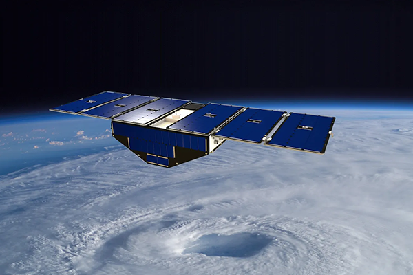
When NASA’s Cyclone Global Navigation Satellite System (CYGNSS) launched into orbit in 2016, none of the University of Michigan Engineers who developed the system expected it to transform earth science. They certainly had high hopes for the system’s original mission to improve hurricane forecasting, but its ability to pick up reflected GPS signals also proved useful for so much more.
Although the CYGNSS mission is scheduled to end this December, it paved the way for ten similar systems that are now operated by government agencies and companies for monitoring and forecasting droughts, wildfires, floods and even locust swarms. One of the newest constellations—a wildfire-monitoring system called FireSat—was named one of Time’s Best Inventions of 2025. The Silicon Valley company behind FireSat, Muon Space, will launch three additional satellites into orbit this summer.